No pain, no gain! No guts, no glory! Well, this is how I best describe our experience in Itbayat.
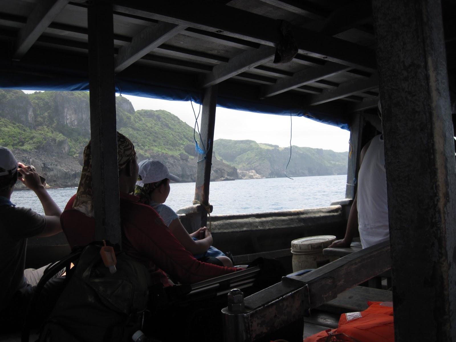
The pain and the guts part refers to our adventure at sea, as we journey to this northernmost island of the Philippines.
Read more about our sea adventure entitled Itbayat, Batanes: Adventure at Sea
Now on to the gain and glory :-)
After a challenging journey to get here, what's a better welcome than a warm reception from our homestay host, Nanay Cano of Cano Homestay. Nanay Cano is the overall coordinator and tourism officer for all the homestays in the island, but lucky us, we get to stay at her home.
With a bit of lull time after a hot meal of pork sinigang soup (sour Filipino soup made from tamarind) and fried fish, we began to explore the town and headed out to the main municipal plaza, which was just a block away from the homestay. The town was quiet with a few curious local kids wondering around. As we were observing the short bonsai-looking trees along the plaza, I suddenly glimpse a pair of knees up above the tree, and heard some giggles. Here's what I saw :-)
Now, Itbayat used to be a coral, and is now considered one of the world's biggest uplifted corals. No wonder we see the short trees and glimpses of rocks around. The gardens at Cano homestay is an example. The short palm trees are popularly known of Vuyavoy, which is actually the palm leaves that are used to make the traditional Vakul.


The white church outlined in red stood out in the town center. It was the old Spanish church of Mayan, and today is still led by a Spanish priest, Fr, Dennis. We headed to the main church door, which appeared to be closed. A plaque stood by the wall indicating the church was built in the 1800's. Suddenly, a small shy girl came strolling along the church grounds and we asked her if the church was open. She didn't seem to know the language, but clearly understood why we were there. She led us through a small alley by the side of the church to the side entrance. Beside the church was a house, with a tall swing. A few bunches of onions, garlic, and corn lay on the floor which were obviously being put out to dry. A rooster sits by the garden, and her father was working on some handicrafts in a nearby hut.
 |
| The shy little girl who welcomed us to the church |
 We entered the church to get a feel for what this meant to the locals, a pride and joy that represents the loyalty and hard work of the people who built this in the 1800s via an assembly line of people from the port, transporting building materials to the church. The church is big, considering the small population of the island, but is simple and emanates a warm comfortable feeling. It was also interesting to note that there were two altars, the inner one was built in front of the old one when the church was renovated in the 80's. I forgot the reason behind it, but today, you could actually see two crucifixes. We paid our respects and took some photographs and headed back just in time for another adventure on the open truck. It was a struggle just to get up and down from the back of the truck, but our driver was clever enough to park near the wall of the homestay close enough for us to use it as a step to the stool nearby.
 |
| View from the back of the truck where we stood |
Our goal was to get to Torongan Hills before sunset. Our truck brought us to the jump off point where we would trek about an hour to the cave via a supposedly short-cut path amongst trees and rivers. Like children, we would frequently ask our local guide the favorite question "Are we there yet?" haha! And he would always reply with "malapit na" which means we're near. But 10 minutes after, we were still walking and the same reply would come when we asked. I guess the word "near" is relative and it means differently to someone who treks these paths everyday and someone who comes from the city. After a few more ten minutes, we were finally at the entrance of the cave. But wait, there's more, we have to hike down the big boulders to get there! With some patience, we finally got to the bottom and the cave looked like a huge round ampitheater and at the far end of it was a big hole in the cave that overlooks the deep blue sea. The cave was believed to be the old dwelling place of the Austronesian aborigine migrants 4000 years ago, and you could see a small ruin of a stone wall that once stood at the entrance of the cave.
 |
| That's us at the path, photo by Ferdz Decena |
 |
| Entrance at the top of the cave |
 |
| Mouth at the far end of the cave that overlooks the blue sea |
 |
| Stone Wall at the entrance of the cave |
After some spelunking, we headed up to the hills above the caves so that we could see the burial markers of the Austronesians. Vast plains of lush green hills met us as we emerged from the cave down below. We could hear our breaths as we become awestruck from the view we see before us. We got to the top where we can see the Eastern coast of Itbayat, the Torongan cliffs, and the nearby island of Dinem, an uninhabited island. For a moment there, the cliffs that met us looked like the famous Moher cliffs of Ireland, a place I've always seen in books and magazines, but never visited yet. My mind wanders and I begin to imagine a scene where I'm a tiny being standing so small on tip of the long stretch of island on top of the cliffs, and looking out to infinity. Literally breathtaking, from the tiring hike up, as well as from being in awe at the scene we see in front of us.
 |
| Torongan Cliffs, Eastern Coast of Itbayat |
Up a bit further, this path leads us to the Burial Markers, 7 of them, all boat-shaped facing the sea, which ancients believe that will take them to the afterlife. Although most of them have been damaged, you can see parts of it but can't make out the shape for most. It is an interesting history where this northern island was part of Spain, then fell into the Dutch hands who were finally expelled by the Chinese. Taiwan (Formosa) is actually much nearer in distance to Itbayat than the main islands of Basco and Sabtang. Only traces of the language remain in the form of Ivatan, where some words resemble the language of the Austronesians.
 |
| Path leading to the burial markers |
 |
| One of the remaining burial markers on the left |
 |
| At Torongan Hills, view of Dinem Island at the far end |
 |
| View of the Torongan Cave and the Cliffs on the Background |
The following morning, we went up to Mt. Karoboboan for the sunrise. At 4am, we had to get ready in the dark as the power has not come back on yet. It is common in places like these to have a schedule a limited operation for the power generators only on certain time of the day where it's needed most. We arrived at the view point on Mt. Karoboboan, just in time to see the sun rise. It was magical. As we satisfy ourselves with all the shots we've taken, breakfast was already waiting for us, a huge portion of rice wrapped in banana leaves, and adobo pork. Yummy!
 |
| At the viewpoint, at the hut where we had our breakfast |
 |
| White snails, edible local delicacy, Mang Tobias had been picking them while waiting for us |
 |
| My photo of the white snails that got featured in CNN Go program: Eye on the Philippines |
Before heading back, we made a last stop at Paganaman Port, a fisherman's port. After a tiring two days, I decided to stay at the top of the hill and enjoy the breeze while the others headed down to the port. A lone fisherman was skin diving, trying to make his catch while another perched off the docks below. The views from up above were magnificent, and once again, I find my mind wandering beyond the infinity of the horizon up in front of me.
 |
| Path down to the docks |
 |
| Fisherman skin diving |
 |
| Down at the docks, a fisherman perches over to make his catch |
 |
| Magnificent View |
And so, here ends our adventure in this interesting island which stands at the edge of our beautiful Philippines.
And here's my My Tripadvisor Review of the Itbayat Burial Caves
You can also read my other trip reports on Batanes:
Sabtang Brought Me Back In Time